Bud Mathis Spring
Bud Mathis Spring
Overview
Bud Mathis Spring is a little-known spring in the upper Chipola River basin of the Florida Panhandle. The spring is located in a rural area near Malone, Florida, in northern Jackson County, where forested creek bottom, wetlands, and farmland meet.
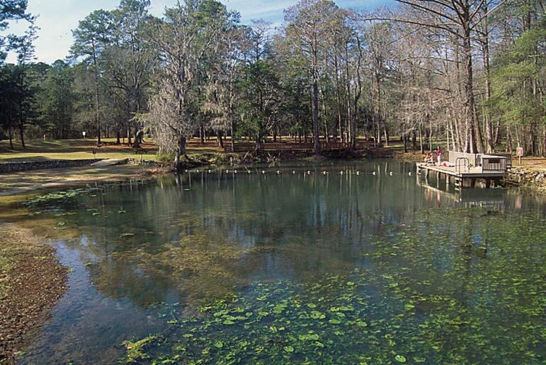
Unlike better-known Jackson County springs such as Jackson Blue Spring or the springs of Merritt’s Mill Pond, Bud Mathis Spring is not a developed public recreation site. It is a small, remote spring documented in regional water-resource surveys but rarely covered in public-facing spring guides.
Because so little information is available online, Bud Mathis Spring is easy to miss. Still, it is part of the broader network of groundwater-fed springs and spring runs that help define the Chipola River system.
County and GIS Data Note
Bud Mathis Spring should be listed as being in Jackson County, not Washington County.
The State of Florida GIS dataset places Bud Mathis Spring under Washington County. However, the coordinates associated with that same listing point to Jackson County. The Northwest Florida Water Management District’s Chipola River spring inventory also identifies Bud Mathis Spring as a Jackson County spring.
For that reason, the Washington County label in the GIS dataset appears to be an error or county-field mismatch. The coordinates and original spring inventory documentation support Jackson County as the correct location.
Setting and Location
Bud Mathis Spring is located near Cowarts Creek, a tributary within the upper Chipola River drainage. The spring lies in a low, wooded landscape where swampy creek bottom transitions into nearby uplands and agricultural land.
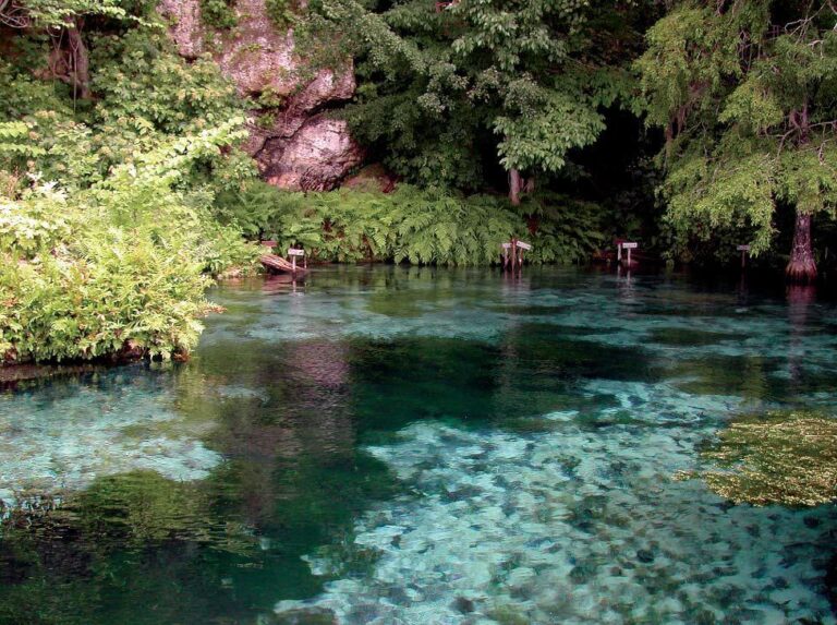
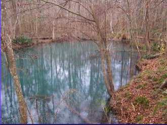
The spring pool is approximately 35 feet across. From the pool, a short spring run flows about one-quarter mile before reaching Cowarts Creek. The east side of the spring run is described as low swampland, while the west side is bordered by a clay bluff about 12 feet high.
Spring Description
Bud Mathis Spring was documented as a small spring pool with tannic water. During the spring inventory survey, the water was too dark to clearly observe the vent, which is common in swamp-connected systems where leaves and organic material stain the water brown.
The estimated depth near the vent area was about 11 feet. Because the spring was influenced by sheet flow from surrounding wetlands, discharge was not measured during the survey. As a result, the exact flow rate and magnitude of the spring are not well documented.
Although the spring does not appear to be a major recreation site, it remains an important small feature within the larger Chipola River spring system.
Geology and Hydrology
Bud Mathis Spring is part of the karst landscape of the Florida Panhandle. In this region, groundwater moves through limestone and can emerge as springs, seeps, spring runs, and creekside vents.
The spring’s tannic appearance likely reflects its floodplain setting. Rather than emerging as a bright blue, high-visibility spring, Bud Mathis Spring appears to be a quieter system where groundwater mixes with wetland-influenced surface water.
Water-quality measurements collected during the 2004 spring inventory recorded cool spring water, with a temperature of about 19.3°C, or roughly 67°F. That is consistent with groundwater-fed springs in the region.
More Resources
- Chipola River Spring Inventory: Jackson and Calhoun Counties, Florida
Photo: Chipola River Spring Inventory, 2004.
Sorry, no records were found. Please adjust your search criteria and try again.
Sorry, unable to load the Maps API.
Nearby Springs