Millers Ferry Spring
Millers Ferry Spring
Overview
Millers Ferry Spring (Miller’s Ferry Spring) is a wild spring on Holmes Creek in Washington County, Florida. It is one of the many lesser-known springs that feed the Holmes Creek system, but it stands out for its large spring pool, blue water under the right conditions, and connection to one of the historic crossings of the creek.
Unlike Cypress Spring, which is widely known and heavily visited, Millers Ferry Spring remains much quieter. It is not a developed park, and there are no major facilities at the spring itself. The spring is best reached by water and is easiest to appreciate when Holmes Creek is at normal or low water levels.
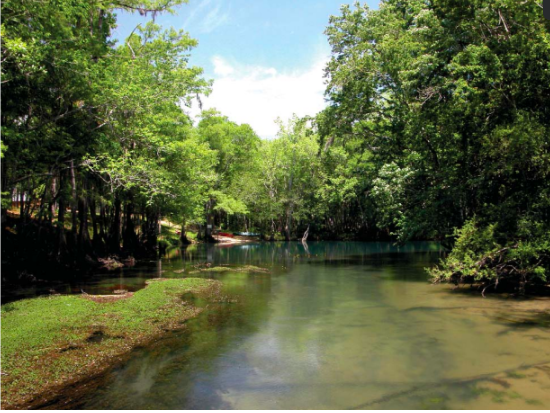
When conditions are right, Millers Ferry Spring can be surprisingly beautiful. The spring pool opens into a broad, calm area along the creek, with clear blue-green water visible beneath the surrounding tannic flow of Holmes Creek.
Setting and Location
Millers Ferry Spring is located on the east side of Holmes Creek in Washington County, Florida, north of the bridge on Millers Ferry Road. The spring lies in the floodplain of Holmes Creek, in a heavily wooded setting with cypress, red maple, tupelo, and other bottomland vegetation.
The spring is located near Millers Ferry Landing and is part of the broader Holmes Creek paddling corridor. Although it sits close to a named road crossing, the spring itself is not a roadside attraction. It is best approached from the water, and it can be easy to miss without knowing where to look.
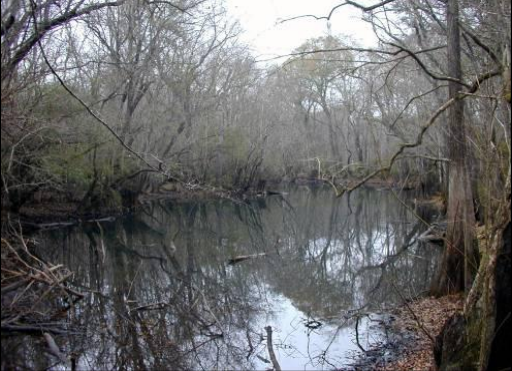
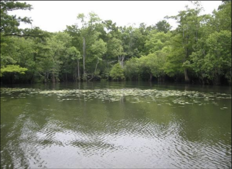
The surrounding landscape is classic Holmes Creek floodplain: dark creek water, quiet side features, broad spring pools, submerged limestone, and heavily vegetated banks.
Spring Description
Millers Ferry Spring is described in regional spring survey materials as having a spring pool about 150 feet in diameter. The vent lies beneath a limestone ledge and is approximately three meters, or about ten feet, across.
The maximum depth of the spring pool has been reported at about 12.5 feet. The spring pool is cut into the east bank of Holmes Creek, and its flow enters the creek quickly rather than forming a long, separate spring run.
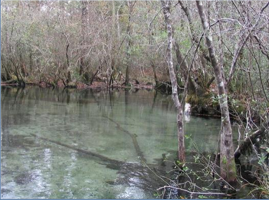
No surface boil was observed during the spring survey, but the vent and limestone feature beneath the water can be visible when conditions are favorable. In clear, low-water conditions, the spring can show a bright blue color that contrasts sharply with the darker water of Holmes Creek.
The spring pool is broad and quiet, with gently sloping banks and a heavily wooded floodplain setting. It has the feeling of a hidden side pool rather than a developed swimming spring.
Water Clarity and Seasonal Conditions
Millers Ferry Spring can change dramatically depending on the level of Holmes Creek.
At normal or low water, the blue spring water may be visible, and the spring pool can look clear and inviting. During higher creek levels, tannic water from Holmes Creek can back-flood into the spring area, reducing visibility and making the spring look much darker.
This is one of the most important things to know before visiting. Millers Ferry Spring is not always bright blue from the surface. The best viewing conditions are usually when Holmes Creek is not running high.
Video footage and local spring reports show that timing matters. At lower water, the spring’s blue color and underwater limestone features are much easier to see. At higher water, the spring may blend into the tannic creek and be much harder to recognize.
Geology and Hydrology
Millers Ferry Spring is part of the karst spring system that feeds Holmes Creek. Groundwater from the Floridan Aquifer emerges through limestone, adding cool spring water to the creek.
Field measurements from a regional spring survey recorded the water temperature at about 20.8°C, or roughly 69°F. Specific conductance was measured at 237 µS/cm, dissolved oxygen at 2.02 mg/L, and pH at 6.9.
The spring is not one of the largest springs on Holmes Creek, but it is still a meaningful contributor to the system. Its broad pool, limestone vent, and direct connection to Holmes Creek make it an important part of the creek’s spring-fed character.
History of Millers Ferry
Millers Ferry Spring takes its name from the historic Millers Ferry area along Holmes Creek. Local history accounts connect the crossing with William Miller, an early settler in the region, and describe the site as an important place to cross Holmes Creek before modern roads and bridges.
Recreation and Access
Millers Ferry Spring is best suited for paddlers, explorers, and spring enthusiasts who are already traveling Holmes Creek.
There are no developed facilities directly at the spring. There is no boardwalk, restroom, concession area, or marked swimming platform at the spring itself. The spring is reached by water, and visitors should be prepared for natural, undeveloped conditions.
The spring has been used locally for swimming and fishing, but it should not be treated like a managed swimming park. Conditions can vary, banks may be muddy or vegetated, and water clarity depends heavily on creek levels.
Paddlers should watch for the spring on the east side of Holmes Creek near the Millers Ferry Road area. Because the spring can blend into the creek when water is high, it may take patience to identify.
What to Expect
At the right water level, Millers Ferry Spring can be one of the prettier hidden springs on Holmes Creek. The pool may show blue-green spring water, fish, submerged limestone, and a peaceful forested shoreline.
At the wrong water level, it may look like a dark, tannic bend or side pool of Holmes Creek. That does not mean the spring is gone; it simply means creek water is masking the clearer spring flow.
More Resources
- Northwest Florida Water Management District spring inventory — Millers Ferry Spring
- Northwest Florida’s Millers Ferry Spring — EarthTripsTV video
- Florida Panhandle Springs and Fossils — Millers Ferry Spring Facebook post
Photo credit: Northwest Florida Water Management District, Holmes Creek Springs Inventory: Washington County, FL, Water Resources Special Report 2008-01.
Sorry, no records were found. Please adjust your search criteria and try again.
Sorry, unable to load the Maps API.
Nearby Springs