Shady Brook Springs / Shady Brook Head Springs
Shady Brook Springs / Shady Brook Head Springs
Shady Brook is one of the spring-fed tributary systems feeding the southern side of Lake Panasoffkee in Sumter County. Rather than being a single famous swimming spring, it is better understood as a quiet spring-fed creek system with multiple named springs, boils, and headwater features scattered through swamp, pasture, and private lands.
The naming can be confusing because several sources use overlapping names. In general:
- Fenney Spring is treated as the head of Shady Brook.
- Shady Brook Head Spring #2 is also identified as Blue Spring.
- Shady Brook Head Spring #3 appears to have been investigated but was not flowing during one USGS visit.
- Shady Brook Head Spring #4 appears on maps and spring lists but was not accessible during the USGS study, and researchers did not find evidence of a substantial run from adjacent public land.
Overview
The Shady Brook spring system lies east and southeast of Coleman, eventually flowing toward Lake Panasoffkee. The broader area is part of the Lake Panasoffkee Springs Group, a cluster of small springs in southern Sumter County. Many of these springs are hidden in swampy, undeveloped, or privately owned areas rather than being managed as public recreation sites.
Hydrologically, Shady Brook matters more than its low profile suggests. USGS research on Lake Panasoffkee found that Shady Brook and Little Jones Creek were major contributors of surface-water inflow to the lake during the study period. Shady Brook’s monthly contribution varied widely depending on conditions.
Shady Brook Head Spring #2 / Blue Spring
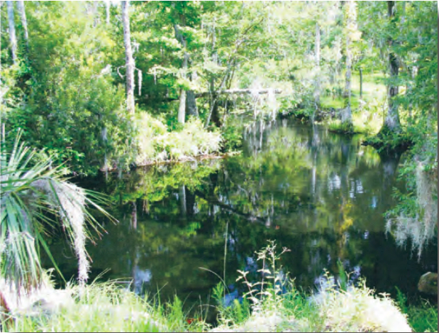
Shady Brook Head Spring #2, also known as Blue Spring, is one of the better-documented springs in this small system. It is located southwest of Fenney Spring and is surrounded by private property. Older descriptions describe a small spring pool with a visible boil and foot-only access. Water from the spring flows through a short run before entering Shady Brook.
This is probably the strongest standalone entry of the group because it has an alternate name, water-quality data, and a clearer physical description.
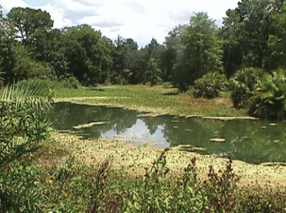
Shady Brook Head Spring #3
Shady Brook Head Spring #3 appears to be a mapped spring feature in the Shady Brook area, but the USGS investigation found it was not flowing during an August 2006 visit. The vent was reportedly silted in and did not appear to have flowed for many years.
For visitors, this is not a practical destination. Its value is mostly scientific and historical, as part of documenting the full Shady Brook/Lake Panasoffkee spring network.
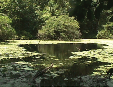
Shady Brook Head Spring #4
Shady Brook Head Spring #4 is listed in spring inventories, but available information suggests it is on private property and was not accessible during the USGS study. Researchers also noted that reconnaissance from nearby public land did not reveal a spring run, making it unlikely that this spring contributes substantial flow to Shady Brook.
This should probably be a very short directory entry unless you later find better field reports or photos.
Access
Most of the Shady Brook springs are not public swimming destinations. Several are on private land, difficult to reach, or embedded in swampy terrain. Shady Brook itself may be encountered as part of broader paddling routes near Lake Panasoffkee, but individual spring access should be treated cautiously and verified before visiting.
More Resources
- USGS: Hydrology, Water Budget, and Water Chemistry of Lake Panasoffkee, West-Central Florida
- SWFWMD: The Hydrology and Water Quality of Select Springs in the Southwest Florida Water Management District
- SWFWMD: A Plan for the Use and Management of the East Lake Panasoffkee Property
Photo published in The Hydrology and Water Quality of Select Springs in the Southwest Florida Water Management District (SWFWMD)
Sorry, no records were found. Please adjust your search criteria and try again.
Sorry, unable to load the Maps API.
Nearby Springs